Friday, October 26, 2012

Sandy becoming extra tropical

Sandy is quickly transforming into a baroclinic system as the storm expands. The forecast gets interesting now and there is a lot of conjecture and hype with the storm and what is going to occur. The way to avoid the impending panic from the media is to turn the channel. Turn on your computer and go to weather.gov then click on your location on the map. 
The talk from the forecast offices is calm and they know the problems locally better than most others because these offices have been around a long time and seen many of these transitional storms move up the US coastline. With this in mind I will give you some observations that may be useful.
The latest reconnaissance mission through the storm has found only 40 knots near the center but there are flight level winds surrounding the broad circulation nearing 50 to 55 knots. 

000
URNT12 KWBC 270029
VORTEX DATA MESSAGE  AL182012
A. 26/23:52:49Z
B. 27 deg 25 min N
  077 deg 14 min W
C. NA
D. 40 kt
E. 132 deg 79 nm
F. 234 deg 57 kt
G. 132 deg 69 nm
H. 971 mb
I. 12 C / 3659 m
J. 13 C / 3660 m
K. 9 C / NA
L. NA
M. NA
N. 12345 / NA
O. 1 / 6 nm
P. NOAA2 1218A SANDY OB 21
STRONG BANDING NW
MAX FL WIND 57 KT SE QUAD 23:35:53Z
MAX OUTBOUND FL WIND 52 KT NW QUAD 00:07:32Z
MAX FL TEMP 15 C 128 / 29 NM FROM FL CNTR
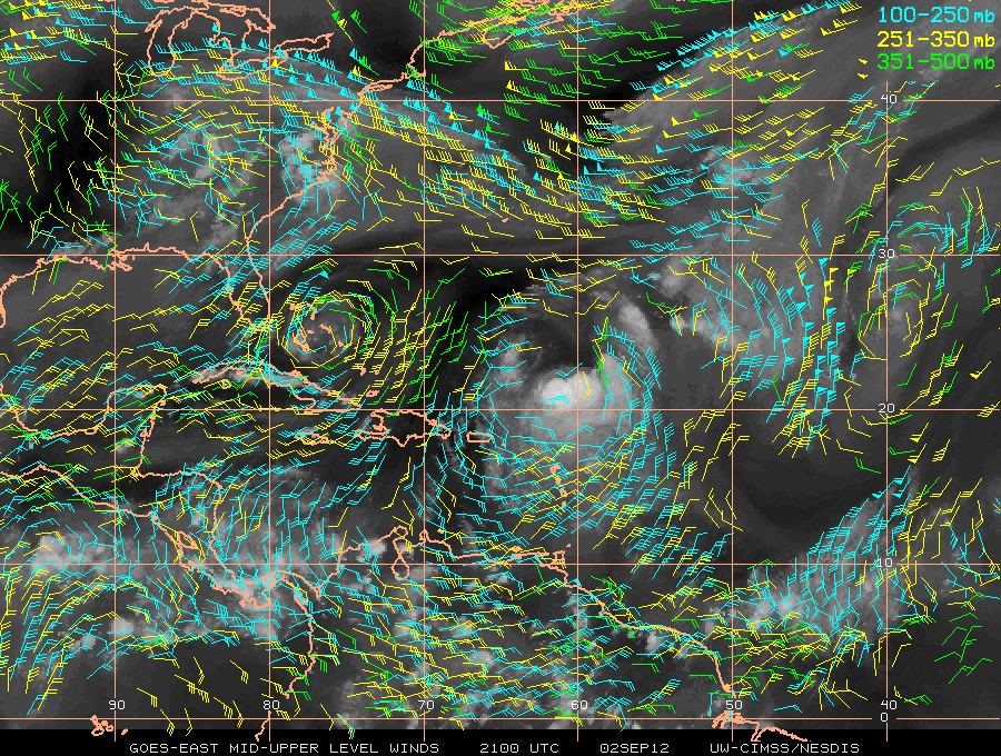
The strong banding features are associated with the large circulation expanding and transitioning to a baroclinic low. When a tropical system transitions into an extra tropical low it implies the poleward motion of the cyclone displaced from the low level circulation and the primary energy source is the baroclinic, or a change in temperature and pressure rather than the pressure and release of latent heat release of condensation due to rising warm moist air off the surface. (fig 1)

If you live along the eastern seaboard of the United States the main issue is for the coastal communities for seas, some coastal flooding especially those very low lying areas, and for rainfall from the storm which may be significant. I can only say that "IF" the model guidance is correct this could be a very large player in the forecast for the weekend. That it is the weekend that the timing could be much worse and involve commuters to work. The storm is coinciding with the astronomical high tide due to the fall tide maximum and a full moon which will add to the coastal flooding.  
My advise is to be prepared, don't panic because your been here before either in hurricanes or nor'easters. Be sure to keep your weather radio handy and get supplies early. Power outages may occur, there could be some flash flooding in those areas prone to it. The best plan is to have a plan and be ready to implement it!
Let me know if and what impacts you receive from the storm. Be Safe
BC

Tuesday, October 23, 2012

TS Sandy

Tropical Storm Sandy is in the Caribbean just south of Jamaica at 11 pm EDT on 10.23.12.
This would put the center about 715 miles south southeast of Key West and it is moving north northeast near 8 mph. The maximum sustained winds are 50 knots but Hurricane Hunter Aircraft have measured 60 knots by dropsonde during a recent pass through the storm.
The structure of Sandy is troubling with respect to the forecast track and intensity. 
Shear(yellow), Shear vectors(white), and vis/wv satellite via CIMSS
The shear vectors are obviously tilting the storm to the east and northeast with the magnitude of the shear at 60 knots over the Bahamas...and near 20 knots across the center fix of the storm. All the shear is out of the southwest. The satellite image shows the slant of the system and a closer look with IR satellite shows the western semicircle of the storm is quite dry and pushing a dry slot into the circulation itself. see below
The latest advisory has the fix further to the east and is the reason for the bend in the track to the east initially. My thinking is this is a trend that will continue for several reasons. First the shear is tilting the storm, this is causing the wind field to expand which is indicating a system that is in transition from tropical to post or extra tropical. Then the culprit for the transition is the upper level low over the eastern Gulf of Mexico which is also helping to steer Sandy, while pulling dry air aloft into the circulation. Finally the last consensus model runs all have a easterly trend to the tracks. see next image

 We find the tracks are east of the official beginning as the storm crosses eastern Cuba. In almost all cases it has been shown that if the consensus moves in a certain direction the tracks will follow. 


As for intensity we will have to wait but would expect that category two will be the maximum that the storm is advertised from NHC but with the expanding wind field, most of the winds should remain aloft and not mix down to the surface. Jamaica will give us a good idea of the energy at the surface as will Cuba. Then the next stop on the Sandy train after the Bahamas will Bermuda but the forward speed should less the duration of impacts no matter what the intensity. 
If you're heading to Key West its going to be windy but this will not stop the debauchery on Duval Street. :-)

Tuesday, October 16, 2012

Rafael fighting to the last

Rafael is working against the shear as much as it can. We can see the sheared storm environment with the bulk of the cloud off to the north and east of the center. 
Courtesy of CIMSS 
The storm is holding on by the skin of its teeth and from ship observations we see the extent of the wind field is limited to the near storm environment. 

A look at wind vectors and then vorticity we can see the trough moving across the western Atlantic which  is the catalyst for pushing Rafael east of Bermuda. The image below shows the high shear surrounding the storm.
The highlighted areas in the final image indicate 200 mb vorticity which is the trough over the western Atlantic and ultimately what will pick up Rafael and begin the rapid exit of the storm to the northeast of Bermuda. 
Obviously there will be some higher winds across Bermuda but the more important issue will be wind waves and swell from the time Rafael has spent over the open waters. 

Friday, October 12, 2012

Rafael

Rafael has been initiated. I will hold off on the obvious and let those of you that know me interpret the facts.
50 knots of shear with a immense ridge building off the Eastern Seaboard which will only add to the shearing environment.
 The track if Rafael holds on keeps the storm heading more north and if you notice the distance between the forecast points, it really speeds up as it get caught up in the trough. This should keep the impacts to Bermuda minimal in both intensity and duration. Winds should be gradually increasing with the trough closing in and may get a little squally Monday night. Not nearly as bad as a strong front dropping out of a Nor'easter.
BC 

Patty and Invest 98L

Good morning everyone,

Just a few notes of the tropics with the last gasp from Patty, and a open wave that may be named Rafael. Patty is being absorbed by a trough sitting across the Bahamas and will likely be out of the picture this evening. The structure of Patty is already non tropical with very little indication of a closed circulation at the surface. 
Thanks to CIMSS for image
With this said lets focus on Invest 98L. 98L is indicated on the above image by the I over the Windward Islands. A recent OSACT pass has a very good representation of the environment around the area. 
 This circulation has a couple of problems least of which is the interaction with the northern coast of Venezuela that is inhibiting the circulation on the southern semicircle of the system. The only storms in recent history that I can remember surviving this interaction were Dennis and Emily in 2005.  The shear across the area north and west of 98L is extremely hostile for development but there is ample deep convection over the Windwards near Barbados that warrent at least keeping an eye on the area. Forecast models are consistently developing a hurricane but the track is almost due north. The other problem is that the ridge over the southeast will offer plenty shear to the west which is the likely reason for the track north. The only issue for this system which may be named Rafael, is Bermuda. 
The following images show the shear then the shear tendency over the area. 
The season isn't over yet. 
BC

Friday, September 7, 2012

Leslie final days

Leslie does not look very healthy with the circulation center open across most of the western semicircle. The shear is increasing and moving closer to the storm from the west. 


The track hasn't changed much, and neither has the intensity forecast from NHC. I will go out on a limb here though. The shear tendency and lack of organized core will likely mark the demise of Leslie's chances to re-intensify. 

An earlier visible satellite image from Leslie shows arc clouds in wavelets rounding the northwest quadrant of the storm. Likely caused by gravity waves emulating from looks like a mid level vorticity north of the low level center. These could help the scouring out of the environment across the western edge. To show this and because I'm off after a long set of long shifts, I thought I'd have a little fun and make a video of the visible images. Testing out the Stupeflix application. 
As for the Gulf of Mexico and the not very interesting mess there. Down to 20% chance for development but the circulation is looking weak much less that the convection is totally displaced. 


Thursday, September 6, 2012

Track for Leslie behaves well. Updated

The forecast track this evening is more to the east again:

The latest track forecast continues the eastward shift due to the trough over New England picking up the upper level low east of the FL/GA coast. This low will slowly move northeast while blocking the path of Leslie, and moving the path to the east. A loop of the water vapor imagery clearly shows the trough moving the upper low. http://www.goes.noaa.gov/HURRLOOPS/huwvloop.html
Will keep this post short but it is good news for Bermuda.
Here is what the storm looks like...
You'll notice the bulk of the vigorous convection on the northern and eastern quadrants of the storm. The last graphic will show the forecast track of the storm.

Wednesday, September 5, 2012

Leslie future track is further east

The National Hurricane Center NHC has upgraded Leslie to hurricane status this afternoon. From the satellite presentation and Oceansat-2 winds I think this is a prudent assesment of the strength in the core of Leslie. 
On the wider view of the Oceansat data we see a very good circulation that is tilted eastward with the strongest winds over the northeast quadrant. Unfortunately NOAA and the Air Force Hurricane Hunter Aircraft are not flying into the storm. NASA is sending a Global Hawk over the storm tomorrow which may reveal the upper flow patterns and more about the tilt of Leslie, providing additional information for the models. This could help to pin down the track even more. A closer view of the Oceansat data (below) shows 65 knots from satellite derived winds near the center of circulation just northeast of the center. 
The visible satellite view shows a slightly better organization to the storm today.
The track has shifted to the east as mentioned above, although possibly due more to the upper low northeast of Bermuda than the trough moving across the New England Coast.
There is some developing wind shear to the west of Bermuda with a COL region (region of little winds and wind shear) to the north of Bermuda. 

While the change in track isn't great news for Bermuda, it is better news. If the track continues the shift to the right I would expect the impacts will be less due to the stronger winds in eastern semicircle. Everyone I know, not many, in Bermuda are prepared and waiting. 
Be Safe!
BC

Monday, September 3, 2012

Leslie looking better today.

The satellite presentation from Leslie looks much different than 24 hours ago. From visible satellite loops earlier in the day, the center circulation started out exposed from the vigorous convection to the south and east. Latest satellite interrogation shows the convection is wrapping around the circulation again late this afternoon. This likely signifies a storm at least better better organized. Also think this may induce a period of intensification for several reasons. Here is a look at Leslie 
The ripples near the brightest white are gravity waves propagating outward from the deep convective burst. This image is a little old, couple of hours, but shows the convection engulfing the center of circulation. The image below shows how intense the convection really is with -80 Celsius and colder cloud tops. 
The forecast track has shifted ever so slightly to the west likely due to the forecast models as we haven't really had any trends to follow for the last day or two. The forecast will likely change over the next few cycles as the storm gets its act together so this is not hard and fast yet. My thoughts are if the storm moves west of Bermuda this places the Island in the higher risk area of Leslie. The right front quadrant has statistically the highest winds, more likely to have tornadoes, and greatest storm tides/surge. Recent Oceansat 2 satellite pass shows the winds around Leslie quite well.
The winds are highest on the east side of the storm which reinforces the idea of the right front quadrant as the most potent area of the storm. Another reason that Leslie may intensify is that the shearing around the storm has relaxed, as has the shear tendency.

The NHC wind probabilities indicate that the chance of Leslie reaching hurricane strength is about 50%. Again I think that this may change sometime through the next few forecast cycles due to the more favorable environment around the storm, and better storm-centric  organization. 
The next few graphics show the numerical probabilities, and updated Tropical Storm/Hurricane force winds graphics. 


For my friends in Bermuda, the best advice I can offer is to be prepared. Speak with people that have been there a long time as they will have local experience that will prove invaluable. The folks along New England should be keep a watchful eye on Leslie just in case. I do think the models, especially the GFS...Global Forecast System...have a good handle on the track after 5 days taking the storm, northward, then northeastward with the greatest impact to the Canadian Maritimes before heading out to the North Atlantic. 
I will keep an eye on this one. Leslie is at least proving interesting from a forecasters point of view. Last note...surfers along the Eastern Seaboard, and the boarder islands between the Caribbean and Atlantic are going to have great surf. 
Be safe,
BC 

Sunday, September 2, 2012

Leslie hangs in, Friday's comin!

'Leslie keeps chugging away even though the environment surrounding the system is quite hostile, and the storm itself is rather disorganized. A look at satellite shows some convection near the center of the circulation, but not surrounding it. All images with a few exceptions are from CIMSS: Cooperative Institute for Meteorological Satellite Studies
Space Science and Engineering Center  /  University of Wisconsin-Madison
From the image above we see the "one sided" appearance with most of the convection held to the southern hemisphere of Leslie. The reason for this is the shear in the environment around the storm. The next several images will help describe this better than words. 
First the shearing environment, 
Notice the shear values on the northeast and west quadrants between 40 and 50 knots. The shear tendency is increasing as well in these areas.
To verify this we have several polar orbiting satellites with good passe near the storm, first the Oceansat-2 (OSCAT) observations, followed by the Advanced Scatterometer, (ASCAT)
Notice the higher winds on the east semicircle indicating the shear to the east. Looking further out from Leslie we find the mechanisms responsible for the slow and indecisive motion of the storm during the past 24 hours or so.

Total winds show the upper level low parked over the Bahamas which has begun to retrograde to the west. A trough across the southeast is pushing toward the northern Gulf of Mexico, and a mesoscale ridge is stalled over the northeastern Gulf. A better look at the upper levels only reveals the low very well.
So where is Leslie going? Not very far very fast. Plus the environment may become less hostile for redevelopment late in the forecast. From CIMSS:
From NHC the official forecast which is easier to look at but I like the display from CIMSS better:
The forecast beyond this time frame is uncertain but I am certain that some sources in the media will be touting the future of the storm and the model output. So to soften this I will show you the extended models in the order of the (GFS) Global Forecast System, (ECMWF) European Medium Range Forecast, and the (CMC) Environment Canada models. Environment Canada has proven to be the intensification model of choice. 

All show some significant intensification after 5 days while picking up forward speed and heading for the Canadian Maritimes. This we will have to wait for. The model errors are significantly higher in the extended time periods of the forecast.
Be well,
BC