Leslie hangs in, Friday's comin!
'Leslie keeps chugging away even though the environment surrounding the system is quite hostile, and the storm itself is rather disorganized. A look at satellite shows some convection near the center of the circulation, but not surrounding it. All images with a few exceptions are from CIMSS: Cooperative Institute for Meteorological Satellite Studies
Space Science and Engineering Center / University of Wisconsin-Madison
From the image above we see the "one sided" appearance with most of the convection held to the southern hemisphere of Leslie. The reason for this is the shear in the environment around the storm. The next several images will help describe this better than words.
First the shearing environment,
Notice the shear values on the northeast and west quadrants between 40 and 50 knots. The shear tendency is increasing as well in these areas.
To verify this we have several polar orbiting satellites with good passe near the storm, first the Oceansat-2 (OSCAT) observations, followed by the Advanced Scatterometer, (ASCAT)
Notice the higher winds on the east semicircle indicating the shear to the east. Looking further out from Leslie we find the mechanisms responsible for the slow and indecisive motion of the storm during the past 24 hours or so.
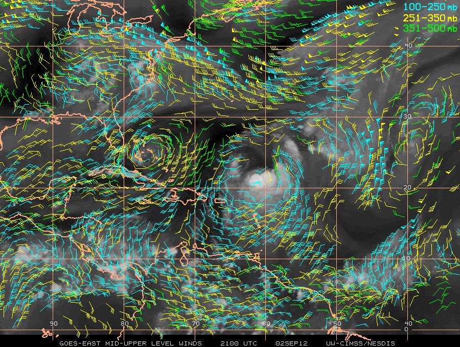
Total winds show the upper level low parked over the Bahamas which has begun to retrograde to the west. A trough across the southeast is pushing toward the northern Gulf of Mexico, and a mesoscale ridge is stalled over the northeastern Gulf. A better look at the upper levels only reveals the low very well.
So where is Leslie going? Not very far very fast. Plus the environment may become less hostile for redevelopment late in the forecast. From CIMSS:
From NHC the official forecast which is easier to look at but I like the display from CIMSS better:
The forecast beyond this time frame is uncertain but I am certain that some sources in the media will be touting the future of the storm and the model output. So to soften this I will show you the extended models in the order of the (GFS) Global Forecast System, (ECMWF) European Medium Range Forecast, and the (CMC) Environment Canada models. Environment Canada has proven to be the intensification model of choice.
All show some significant intensification after 5 days while picking up forward speed and heading for the Canadian Maritimes. This we will have to wait for. The model errors are significantly higher in the extended time periods of the forecast.
Be well,
BC


No comments:
Post a Comment