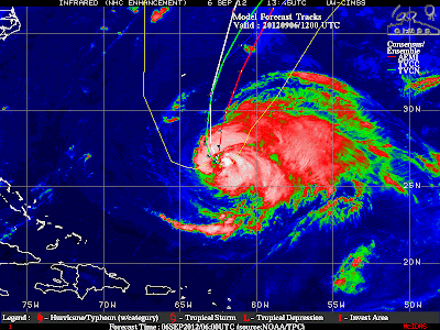
The forecast track this evening is more to the east again:
The latest track forecast continues the eastward shift due to the trough over New England picking up the upper level low east of the FL/GA coast. This low will slowly move northeast while blocking the path of Leslie, and moving the path to the east. A loop of the water vapor imagery clearly shows the trough moving the upper low. http://www.goes.noaa.gov/HURRLOOPS/huwvloop.html
Will keep this post short but it is good news for Bermuda.
Here is what the storm looks like...
You'll notice the bulk of the vigorous convection on the northern and eastern quadrants of the storm. The last graphic will show the forecast track of the storm.


No comments:
Post a Comment