
The storm may be undergoing some RI (rapid intensification) due to dry air to the north wrapping into the center. the proximity to landfall should limit the degree of strengthening.
All my friends along the northern Gulf Coast should have completed preparations. Especially those that live in coastal communities, even as far east as the Big Bend of Florida. The storm surge will be fairly significant as Isaac makes landfall and the wave action will likely cause erosion to the beaches, and in the usual places along Highway 98 across the Florida Panhandle and coastal Alabama. Lets address the numbers on Isaac first, at 11 pm Isaac was located about 190 miles southeast of the entrance of the Mississippi River. The storm is moving northwest (310) degrees near 10 mph, and maximum sustained winds are 70 mph with gusts 75 to 80 mph, using a 1.2 to 1.4 gust factor.
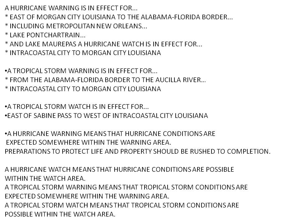
Below is a list of Watches and Warnings from the last NHC advisory.
The track of Isaac has held fairly steady since passing just south and west of Key West last night, likely between the Marquesas Keys and the Dry Tortugas National Park around 6 pm with a minimum pressure of 997.3 at the Key West International Airport.


This is a much weaker storm than Katrina, but should not be underestimated. The storm winds after passage away from Key West were higher than as the storm passed south of the island. The wind field is quite large as was seen with the winds from Northern Broward county through St. Lucie Counties along the east coast of Florida last night. Please be Weather Ready, and be safe. For current watches and warnings along with the fastest updates go to your National Hurricane Center website, and for local warnings, hurricane local statements, and preparedness guides, go to your local National Weather Service web page at the point and click site. Also remember, your best source for weather information on the web ends with .gov not .com. :-) My last midnight shift for 5 weeks with a couple of extras thrown in for fun, I am ready for sleep. Will update tomorrow if I wake up in time for the land falling event.
Let me know how the storm has impacted you through the comments section of the blog.
Cheers,
Bill
No comments:
Post a Comment