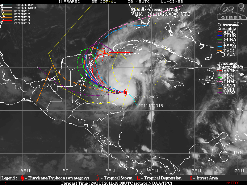
The track forecast is settling down a bit with the HWRF and GFDL as the outlying models. All of the other guidance with the exception of the UKMET office keeps the system meandering around the western tip of Cuba and the Yucatan Peninsula.
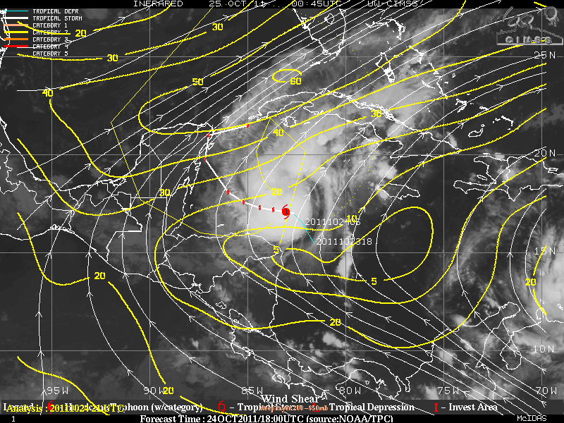
The environment around this storm remains quite hostile for Rina if it moves much to the north. There is 20 knots of shear just north and this increases to near 60 knots over the Florida Straits near Key West. My thinking is that the storm will continue to meander for the next few days while it moves slightly northward over water with high hurricane heat potential, providing the catalyst for the intensification. Then as NHC stated, interactions with the Yucatan and the shearing aloft expect Rina to weaken before it is picked up by a trough moving across the eastern Gulf of Mexico by day 5.
Keep in mind that the run to run consistency in the models is not good, so the model solutions are in question. This is usually the case with slow moving storms.
More tomorrow,
BillyC
No comments:
Post a Comment